Geolocate

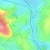
Urbeis topographic map

Click on the map to display elevation.

About this map

Name: Urbeis topographic map, elevation, terrain.

Location: Urbeis, Sélestat-Erstein, Bas-Rhin, Grand Est, Metropolitan France, 67220, France (48.30992 7.16345 48.35317 7.25008)

Average elevation: 554 m

Minimum elevation: 299 m

Maximum elevation: 952 m

Other topographic maps

Click on a map to view its topography, its elevation and its terrain.
Strasbourg

France > Grand Est > Bas-Rhin > Strasbourg

Average elevation: 154 m

Ath

France > Grand Est > Bas-Rhin > Diemeringen

Average elevation: 255 m

Taubensee

France > Grand Est > Bas-Rhin > Niederbronn-les-Bains

Average elevation: 396 m

Le Haut des Monts

France > Grand Est > Bas-Rhin > Belmont

Average elevation: 849 m

Le Climont

France > Grand Est > Bas-Rhin > Urbeis

Average elevation: 621 m

Altenstadt

France > Grand Est > Bas-Rhin > Wissembourg

Average elevation: 172 m

Gear up for your next adventure:

🥾Trekking Boots - Durable boots for long-distance trekking
🔥Camping Stove - Portable stoves to cook outdoors with ease
⛺Lightweight Camping Tent - Portable shelter optimized for Canadian backcountry camping
🧥Fleece Jacket - Warm and lightweight jacket for layering
🧢Hiking Sun Hat - Wide-brimmed protection for exposed mountain ridges

As an Amazon Associate, this site earns from qualifying purchases at no extra cost to you.