Geolocate

Deora topographic map

Click on the map to display elevation.

About this map

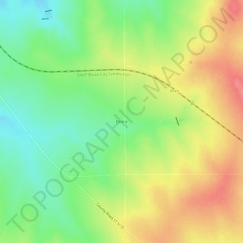
Name: Deora topographic map, elevation, terrain.

Location: Deora, Baca County, Colorado, United States (37.56029 -102.98659 37.60029 -102.94659)

Average elevation: 1,436 m

Minimum elevation: 1,402 m

Maximum elevation: 1,472 m

Gear up for your next adventure:

🥾Waterproof Hiking Boots - Boots keeping your feet dry in wet conditions
🦯Trekking Poles - Reduced impact on joints for steep topographic climbs
🔭Compact Monocular - One-handed bird watching and trail spotting
🧥Waterproof Hiking Jacket - Protect yourself from rain and wind while hiking
🧴Insect Repellent - Protect yourself from bugs during outdoor adventures

As an Amazon Associate, this site earns from qualifying purchases at no extra cost to you.