
Thank you for supporting this site ❤️
Make a donation
Make a donation
Gear up for your next adventure:
As an Amazon Associate, this site earns from qualifying purchases at no extra cost to you.
Sichersdorf topographic map
Click on the map to display elevation.
Thank you for supporting this site ❤️
Make a donation
Make a donation
Gear up for your next adventure:
As an Amazon Associate, this site earns from qualifying purchases at no extra cost to you.
About this map
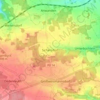
Name: Sichersdorf topographic map, elevation, terrain.
Location: Sichersdorf, Stein, Fürth (district), Bavaria, 91189, Germany (49.37337 10.91293 49.41337 10.95293)
Average elevation: 378 m
Minimum elevation: 324 m
Maximum elevation: 416 m
Thank you for supporting this site ❤️
Make a donation
Make a donation
Gear up for your next adventure:
As an Amazon Associate, this site earns from qualifying purchases at no extra cost to you.