
Les Avirons topographic map
Interactive map
Click on the map to display elevation.
About this map
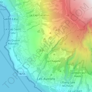
Name: Les Avirons topographic map, elevation, terrain.
Location: Les Avirons, Saint-Pierre, Réunion, 97425, France (-21.25875 55.32023 -21.14468 55.40557)
Average elevation: 670 m
Minimum elevation: 0 m
Maximum elevation: 2,431 m