
Thank you for supporting this site ❤️
Make a donation
Make a donation
Gear up for your next adventure:
As an Amazon Associate, this site earns from qualifying purchases at no extra cost to you.
Sapateira topographic map
Click on the map to display elevation.
Thank you for supporting this site ❤️
Make a donation
Make a donation
Gear up for your next adventure:
As an Amazon Associate, this site earns from qualifying purchases at no extra cost to you.
About this map
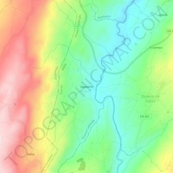
Name: Sapateira topographic map, elevation, terrain.
Location: Sapateira, Prova e Casteição, Mêda, Guarda, 6430-362, Portugal (40.93506 -7.34241 40.97506 -7.30241)
Average elevation: 683 m
Minimum elevation: 532 m
Maximum elevation: 896 m
Thank you for supporting this site ❤️
Make a donation
Make a donation
Gear up for your next adventure:
As an Amazon Associate, this site earns from qualifying purchases at no extra cost to you.