Geolocate

Les Combes topographic map

Click on the map to display elevation.

About this map
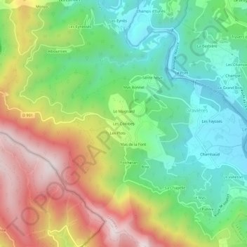
Name: Les Combes topographic map, elevation, terrain.

Location: Les Combes, Gravières, Largentière, Ardèche, Auvergne-Rhône-Alpes, France métropolitaine, 07140, France (44.39982 4.05427 44.43982 4.09427)

Average elevation: 445 m

Minimum elevation: 156 m

Maximum elevation: 884 m

Other topographic maps

Click on a map to view its topography, its elevation and its terrain.

Gear up for your next adventure:

🕯️Camping Lantern - Illuminates your entire campsite with high-efficiency LEDs
🥾Trekking Poles - Adjustable trekking poles to reduce knee stress and improve stability
🧣Merino Neck Gaiter - Protects against wind, sun, and cold at high altitudes
🧊Insulated Water Bottle - Keeps drinks cold in summer and prevents freezing in winter
🥾Mountaineering Boots - Supportive boots for climbing and high-altitude hiking

As an Amazon Associate, this site earns from qualifying purchases at no extra cost to you.