Geolocate

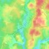
Plaisance topographic map

Click on the map to display elevation.

About this map

Name: Plaisance topographic map, elevation, terrain.

Location: Plaisance, Biron, Bergerac, Dordogne, Nouvelle-Aquitaine, France métropolitaine, 24540, France (44.61044 0.85840 44.65044 0.89840)

Average elevation: 193 m

Minimum elevation: 138 m

Maximum elevation: 237 m

Other topographic maps

Click on a map to view its topography, its elevation and its terrain.
Étang du Moulinal

France > Nouvelle-Aquitaine > Dordogne > Biron

Average elevation: 179 m

Gear up for your next adventure:

⛺Tent Footprint - Protect tent floor and increase durability
⛺Lightweight Camping Tent - Portable shelter optimized for Canadian backcountry camping
🥾Mountaineering Boots - Supportive boots for climbing and high-altitude hiking
🧢Beanie Hat - Keep your head warm in cold weather
🦌Outdoor Trail Camera - Monitor wildlife activity near your favorite spots

As an Amazon Associate, this site earns from qualifying purchases at no extra cost to you.