
26 de Octubre topographic map
Interactive map
Click on the map to display elevation.
About this map
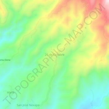
Name: 26 de Octubre topographic map, elevation, terrain.
Location: 26 de Octubre, Tapachula, Chiapas, México (15.06401 -92.27244 15.10401 -92.23244)
Average elevation: 744 m
Minimum elevation: 538 m
Maximum elevation: 1,078 m