
Thank you for supporting this site ❤️
Make a donation
Make a donation
Gear up for your next adventure:
As an Amazon Associate, this site earns from qualifying purchases at no extra cost to you.
Campegli topographic map
Click on the map to display elevation.
Thank you for supporting this site ❤️
Make a donation
Make a donation
Gear up for your next adventure:
As an Amazon Associate, this site earns from qualifying purchases at no extra cost to you.
About this map
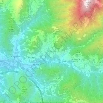
Name: Campegli topographic map, elevation, terrain.
Location: Campegli, Castiglione Chiavarese, Genoa, Liguria, 16030, Italy (44.25877 9.46961 44.29877 9.50961)
Average elevation: 302 m
Minimum elevation: 33 m
Maximum elevation: 979 m
Thank you for supporting this site ❤️
Make a donation
Make a donation
Gear up for your next adventure:
As an Amazon Associate, this site earns from qualifying purchases at no extra cost to you.