
Thank you for supporting this site ❤️
Make a donation
Make a donation
Gear up for your next adventure:
As an Amazon Associate, this site earns from qualifying purchases at no extra cost to you.
Ribabellosa topographic map
Click on the map to display elevation.
Thank you for supporting this site ❤️
Make a donation
Make a donation
Gear up for your next adventure:
As an Amazon Associate, this site earns from qualifying purchases at no extra cost to you.
About this map
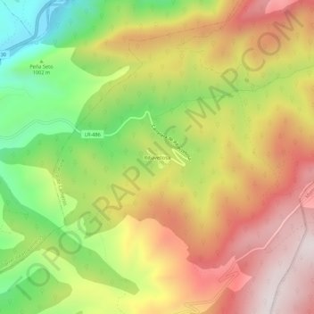
Name: Ribabellosa topographic map, elevation, terrain.
Location: Ribabellosa, Almarza de Cameros, La Rioja, 26100, España (42.22480 -2.61061 42.26480 -2.57061)
Average elevation: 1,091 m
Minimum elevation: 712 m
Maximum elevation: 1,439 m
Thank you for supporting this site ❤️
Make a donation
Make a donation
Gear up for your next adventure:
As an Amazon Associate, this site earns from qualifying purchases at no extra cost to you.