Geolocate

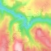
Cublas topographic map

Click on the map to display elevation.

About this map

Name: Cublas topographic map, elevation, terrain.

Location: Cublas, Sauviat, Thiers, Puy-de-Dôme, Auvergne-Rhône-Alpes, France métropolitaine, 63120, France (45.68648 3.53863 45.72648 3.57863)

Average elevation: 484 m

Minimum elevation: 327 m

Maximum elevation: 608 m

Other topographic maps

Click on a map to view its topography, its elevation and its terrain.
La Dore

France > Auvergne-Rhône-Alpes > Puy-de-Dôme > Sauviat

Average elevation: 487 m

Gear up for your next adventure:

⛺Family Camping Tent - Spacious tent suitable for family camping trips
🧳Compression Sacks - Maximize space in your backpack by shrinking gear
🛌Down Sleeping Bag - Superior warmth-to-weight ratio for cold nights
🥾Hiking Boots - Sturdy boots providing ankle support and traction on rugged trails
👟Leg Gaiters - Keep debris, mud, and snow out of your boots

As an Amazon Associate, this site earns from qualifying purchases at no extra cost to you.