
Thank you for supporting this site ❤️
Make a donation
Make a donation
Gear up for your next adventure:
As an Amazon Associate, this site earns from qualifying purchases at no extra cost to you.
Acekeleye topographic map
Click on the map to display elevation.
Thank you for supporting this site ❤️
Make a donation
Make a donation
Gear up for your next adventure:
As an Amazon Associate, this site earns from qualifying purchases at no extra cost to you.
About this map
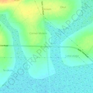
Name: Acekeleye topographic map, elevation, terrain.
Location: Acekeleye, Kole, Northern Region, Uganda (2.29617 32.66694 2.33617 32.70694)
Average elevation: 1,050 m
Minimum elevation: 1,041 m
Maximum elevation: 1,071 m
Thank you for supporting this site ❤️
Make a donation
Make a donation
Gear up for your next adventure:
As an Amazon Associate, this site earns from qualifying purchases at no extra cost to you.