
Thank you for supporting this site ❤️
Make a donation
Make a donation
Gear up for your next adventure:
As an Amazon Associate, this site earns from qualifying purchases at no extra cost to you.
Lavizán topographic map
Click on the map to display elevation.
Thank you for supporting this site ❤️
Make a donation
Make a donation
Gear up for your next adventure:
As an Amazon Associate, this site earns from qualifying purchases at no extra cost to you.
About this map
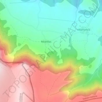
Name: Lavizán topographic map, elevation, terrain.
Location: Lavizán, Revelillas, Valderredible, Cantabria, 39250, Spain (42.76517 -4.08525 42.78517 -4.06525)
Average elevation: 940 m
Minimum elevation: 777 m
Maximum elevation: 1,166 m
Thank you for supporting this site ❤️
Make a donation
Make a donation
Gear up for your next adventure:
As an Amazon Associate, this site earns from qualifying purchases at no extra cost to you.