
İlker Mahallesi topographic map
Interactive map
Click on the map to display elevation.
About this map
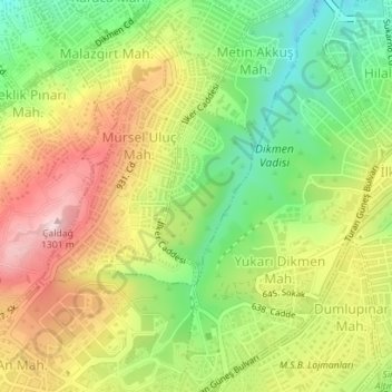
Name: İlker Mahallesi topographic map, elevation, terrain.
Location: İlker Mahallesi, Çankaya, Ankara, Zentralanatolien, Türkei (39.85426 32.83479 39.86657 32.84336)
Average elevation: 1,164 m
Minimum elevation: 1,036 m
Maximum elevation: 1,306 m
Other topographic maps
Click on a map to view its topography, its elevation and its terrain.