Geolocate

Le Barthas topographic map

Click on the map to display elevation.

About this map
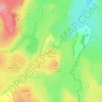
Name: Le Barthas topographic map, elevation, terrain.

Location: Le Barthas, Nasbinals, Mende, Lozère, Occitanie, France métropolitaine, 48260, France (44.62535 3.05988 44.62545 3.05998)

Average elevation: 1,235 m

Minimum elevation: 1,162 m

Maximum elevation: 1,321 m

Other topographic maps

Click on a map to view its topography, its elevation and its terrain.

48260

France > Occitanie > Lozère > Nasbinals

Average elevation: 1,215 m

Gear up for your next adventure:

🥾Light Trekking Boots - Supportive boots for multi-day treks
🔦UV Flashlight - Detect minerals or specific insects in the dark
⛺Lightweight Backpacking Tent - Compact tent for efficient hiking trips
🚲Handlebar Phone Mount - View topographic-map.com live while cycling
🛰️Satellite Messenger - Emergency communication for areas with no cell service

As an Amazon Associate, this site earns from qualifying purchases at no extra cost to you.