Geolocate

Flash topographic map

Click on the map to display elevation.

Flash

Flash is a village in the Staffordshire Moorlands, England, and Peak District National Park. At 1,519 feet (463 m) above sea level, it is the highest village in the United Kingdom. Some sources claim a height of 1,531ft for Wanlockhead in Scotland, but a survey in 2019 showed that there are no buildings in Wanlockhead at that elevation. Flash was an early centre for Wesleyanism.

Wikipedia (CC-BY-SA 3.0)

About this map

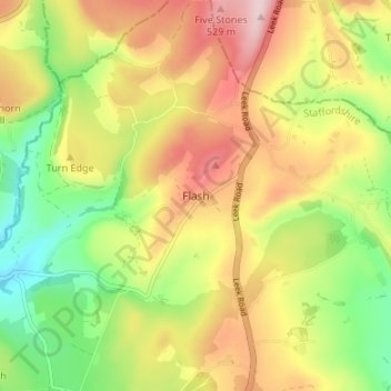
Name: Flash topographic map, elevation, terrain.

Location: Flash, Staffordshire Moorlands, Staffordshire, England, SK17 0TN, United Kingdom (53.18218 -1.98409 53.22218 -1.94409)

Average elevation: 412 m

Minimum elevation: 285 m

Maximum elevation: 548 m

Gear up for your next adventure:

🧴First Aid Kit - Essential first aid supplies for outdoor emergencies
🧣Merino Neck Gaiter - Protects against wind, sun, and cold at high altitudes
🧭GPS Outdoor Watch - Smart watch for navigation and fitness tracking in nature
🧥Softshell Jacket - Windproof and breathable jacket for hiking
🧦Hiking Liner Socks - Thin base layer to prevent friction and blisters

As an Amazon Associate, this site earns from qualifying purchases at no extra cost to you.