Geolocate

Pajonal topographic map

Click on the map to display elevation.

About this map

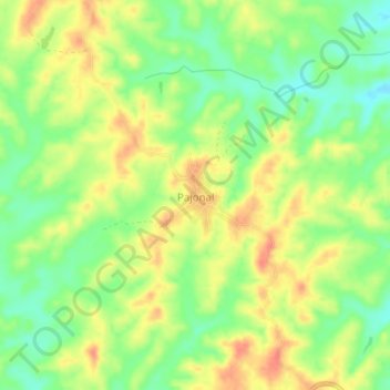
Name: Pajonal topographic map, elevation, terrain.

Location: Pajonal, San Onofre, Morrosquillo, Sucre, RAP Caribe, Colombia (9.82029 -75.50214 9.86029 -75.46214)

Average elevation: 76 m

Minimum elevation: 49 m

Maximum elevation: 102 m

Gear up for your next adventure:

👟Trail Running Shoes - Agile footwear for fast-paced topographic exploration
🥾Hiking Gaiters - Protect legs and shoes from mud, snow, and debris
🥾All-Terrain Hiking Boots - Versatile boots for varied hiking conditions
🧢Sun Hat - Wide-brim hat for sun protection
🛶Waterproof Dry Bags - Keep electronics and clothes dry during river crossings

As an Amazon Associate, this site earns from qualifying purchases at no extra cost to you.