Cozumel topographic map
Click on the map to display elevation.
Cozumel
Large parts of the island are covered with mangrove forest which has many endemic animal species. Cozumel is a flat island based on limestone, resulting in a karst topography. The highest natural point on the island is less than 15 m (49 ft) above sea level. The cenotes are deep water-filled sinkholes formed by water percolating through the soft limestone soil for thousands of years. Cozumel's cenotes are restricted to qualified cave divers with appropriate credentials.
About this map
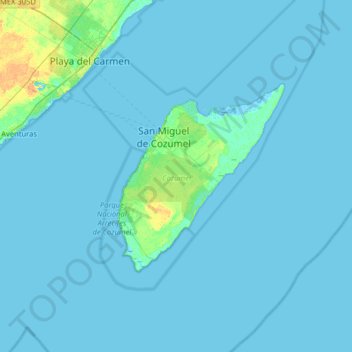
Name: Cozumel topographic map, elevation, terrain.
Location: Cozumel, Quintana Roo, Mexico (20.27159 -87.36343 20.59771 -86.72395)
Average elevation: 1 m
Minimum elevation: -3 m
Maximum elevation: 20 m
Other topographic maps
Click on a map to view its topography, its elevation and its terrain.