
Lewiston topographic map
Click on the map to display elevation.
Lewiston
According to the U.S. Census Bureau, the city has a total area of 18.04 square miles (46.72 km2), of which 17.23 square miles (44.63 km2) is land and 0.81 square miles (2.10 km2) is water. Downtown Lewiston, at elevations between 740 feet (230 m) and 780 feet (240 m), is only slightly higher in elevation than the river, about 741 ft (226 m), which was thirty feet (9 m) lower prior to the completion of the Lower Granite Dam. Away from downtown the terrain gains elevation quickly, as the steep riverbank highway of U.S. 95 north of Lewiston ascends to 2,756 feet (840 m).
About this map
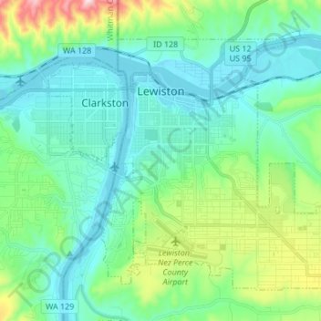
Name: Lewiston topographic map, elevation, terrain.
Location: Lewiston, Nez Perce County, Idaho, United States (46.36165 -117.04659 46.43711 -116.91126)
Average elevation: 334 m
Minimum elevation: 219 m
Maximum elevation: 758 m
Other topographic maps
Click on a map to view its topography, its elevation and its terrain.