Geolocate

Hildfeld topographic map

Click on the map to display elevation.

About this map
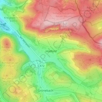
Name: Hildfeld topographic map, elevation, terrain.

Location: Hildfeld, Winterberg, Hochsauerlandkreis, Noordrijn-Westfalen, Duitsland (51.22385 8.54505 51.26385 8.58505)

Average elevation: 681 m

Minimum elevation: 533 m

Maximum elevation: 836 m

Other topographic maps

Click on a map to view its topography, its elevation and its terrain.

Gear up for your next adventure:

💡LED Headlamp - Hands-free illumination for night hiking and camping
🚲Handlebar Phone Mount - View topographic-map.com live while cycling
🧥Thermal Fleece Jacket - Versatile insulation for changing mountain temperatures
🥾Lightweight Hiking Shoes - Comfortable shoes for day hikes
☕Camping Coffee Maker - Brew fresh coffee anywhere on the topographic map

As an Amazon Associate, this site earns from qualifying purchases at no extra cost to you.