Geolocate

Lunz topographic map

Click on the map to display elevation.

About this map

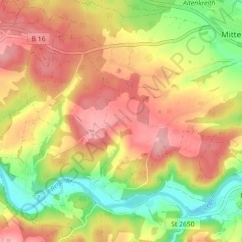
Name: Lunz topographic map, elevation, terrain.

Location: Lunz, Roding, Landkreis Cham, Bavaria, 93426, Germany (49.17198 12.43991 49.21198 12.47991)

Average elevation: 422 m

Minimum elevation: 348 m

Maximum elevation: 483 m

Gear up for your next adventure:

🥾Mountain Trail Shoes - High-traction shoes for mountain trails
🎒Hiking Backpack - Lightweight and ergonomic backpacks for day hikes or multi-day treks
🧼Biodegradable Camp Soap - Environmentally friendly cleaning for gear and body
🗺️Topographic Maps - Detailed maps to explore trails, mountains, and wilderness areas
🥾All-Terrain Hiking Boots - Versatile boots for varied hiking conditions

As an Amazon Associate, this site earns from qualifying purchases at no extra cost to you.