Geolocate

Candajec topographic map

Click on the map to display elevation.

About this map

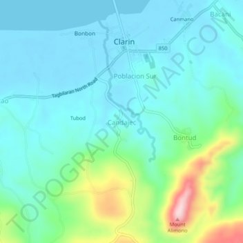
Name: Candajec topographic map, elevation, terrain.

Location: Candajec, Clarin, Bohol, Central Visayas, 3629, Philippines (9.92940 124.00402 9.96940 124.04402)

Average elevation: 60 m

Minimum elevation: -8 m

Maximum elevation: 285 m

Gear up for your next adventure:

🦌Outdoor Trail Camera - Monitor wildlife activity near your favorite spots
🚲MTB Frame Bag - Carry tools and maps directly on your bicycle frame
🚑Survival Whistle - Signal for help across long distances in mountains
🧴Waterproofing Spray - Restore the DWR coating on jackets and tents
🛏️Sleeping Bag - Warm and compact sleeping bags for outdoor camping

As an Amazon Associate, this site earns from qualifying purchases at no extra cost to you.