
Thank you for supporting this site ❤️
Make a donation
Make a donation
Gear up for your next adventure:
As an Amazon Associate, this site earns from qualifying purchases at no extra cost to you.
Mugiligundla topographic map
Click on the map to display elevation.
Thank you for supporting this site ❤️
Make a donation
Make a donation
Gear up for your next adventure:
As an Amazon Associate, this site earns from qualifying purchases at no extra cost to you.
About this map
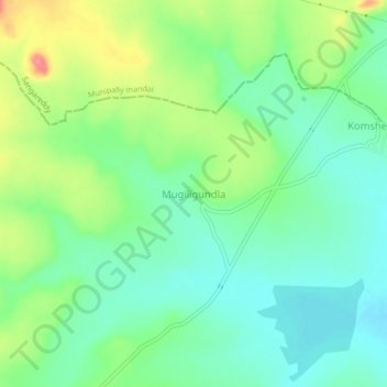
Name: Mugiligundla topographic map, elevation, terrain.
Location: Mugiligundla, Marpalle mandal, Vikarabad, Telangana, India (17.59793 77.79347 17.63793 77.83347)
Average elevation: 592 m
Minimum elevation: 565 m
Maximum elevation: 645 m
Thank you for supporting this site ❤️
Make a donation
Make a donation
Gear up for your next adventure:
As an Amazon Associate, this site earns from qualifying purchases at no extra cost to you.