
Lookout Mountain topographic map
Interactive map
Click on the map to display elevation.
About this map
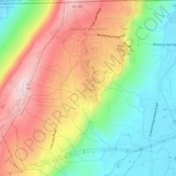
Name: Lookout Mountain topographic map, elevation, terrain.
Average elevation: 406 m
Minimum elevation: 195 m
Maximum elevation: 657 m
Other topographic maps
Click on a map to view its topography, its elevation and its terrain.
Snodgrass Hill
United States > Georgia > Walker County > Fort Oglethorpe
Snodgrass Hill, Fort Oglethorpe, Walker County, Georgia, 30741, United States
Average elevation: 250 m
Rossville
United States > Georgia > Walker County
Rossville, Walker County, Georgia, United States
Average elevation: 251 m