Geolocate

Cavani topographic map

Click on the map to display elevation.

About this map

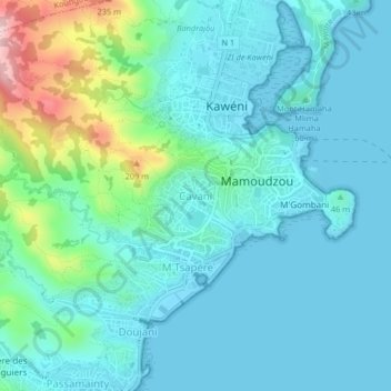
Name: Cavani topographic map, elevation, terrain.

Location: Cavani, Mamoudzou, Mayotte, 96700, France (-12.80194 45.20154 -12.76194 45.24154)

Average elevation: 51 m

Minimum elevation: -1 m

Maximum elevation: 281 m

Gear up for your next adventure:

🧢Beanie Hat - Keep your head warm in cold weather
🏃Hydration Running Vest - Carry water and maps close to your body for speed
🍽️Titanium Camping Spork - Ultralight and indestructible eating utensil
🧥Waterproof Hiking Jacket - Protect yourself from rain and wind while hiking
🕯️Camping Lantern - Illuminates your entire campsite with high-efficiency LEDs

As an Amazon Associate, this site earns from qualifying purchases at no extra cost to you.