Geolocate

Kulmbach topographic map

Click on the map to display elevation.

About this map

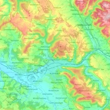
Name: Kulmbach topographic map, elevation, terrain.

Location: Kulmbach, Landkreis Kulmbach, Bavaria, 95326, Germany (50.05456 11.36050 50.19279 11.50480)

Average elevation: 395 m

Minimum elevation: 281 m

Maximum elevation: 619 m

Other topographic maps

Click on a map to view its topography, its elevation and its terrain.

Buchau

Germany > Bavaria > Landkreis Kulmbach

Average elevation: 395 m

Lindenberg

Germany > Bavaria > Landkreis Kulmbach > Lopp

Average elevation: 427 m

Gear up for your next adventure:

🥾Approach Boots - Comfortable boots for hiking and climbing approaches
🔪Outdoor Multitool - Versatile tool for repairs and food prep in the wild
🪜Heavy Duty Carabiners - Multi-use clips for securing gear to your backpack
🧥Waterproof Jacket - Lightweight rain jackets for hiking and outdoor activities
🪑Insulated Seat Pad - Protect your seat from cold rocks and wet logs

As an Amazon Associate, this site earns from qualifying purchases at no extra cost to you.