
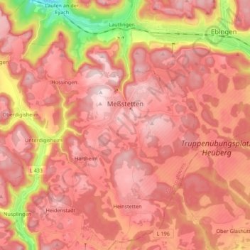
Meßstetten topographic map
Interactive map
Click on the map to display elevation.
About this map
Name: Meßstetten topographic map, elevation, terrain.
Average elevation: 862 m
Minimum elevation: 596 m
Maximum elevation: 989 m
Other topographic maps
Click on a map to view its topography, its elevation and its terrain.
Hartheim
Allemagne > Bade-Wurtemberg > Zollernalbkreis > Meßstetten > Hartheim
Hartheim, Meßstetten, Gemeindeverwaltungsverband Meßstetten, Zollernalbkreis, Bade-Wurtemberg, 72469, Allemagne
Average elevation: 891 m
Jungingen
Allemagne > Bade-Wurtemberg > Zollernalbkreis
Jungingen, Gemeindeverwaltungsverband Hechingen, Zollernalbkreis, Bade-Wurtemberg, 72417, Allemagne
Average elevation: 682 m