Geolocate

Mollebamba topographic map

Click on the map to display elevation.

About this map

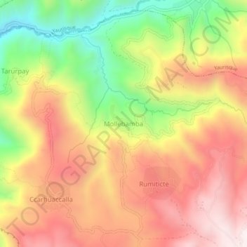
Name: Mollebamba topographic map, elevation, terrain.

Location: Mollebamba, Paccaritambo, Paruro, Cusco, Perú (-13.72797 -71.97986 -13.68797 -71.93986)

Average elevation: 3,438 m

Minimum elevation: 2,982 m

Maximum elevation: 3,808 m

Gear up for your next adventure:

🧤Insulated Winter Gloves - Heavy-duty protection for sub-zero Canadian adventures
🔪Outdoor Multitool - Versatile tool for repairs and food prep in the wild
🕶️Polarized Sunglasses - Reduces glare from snow and water at high elevations
Camping Coffee Maker - Brew fresh coffee anywhere on the topographic map
🔋Solar Power Bank - Keep your GPS and devices charged during long outdoor trips

As an Amazon Associate, this site earns from qualifying purchases at no extra cost to you.