
Thank you for supporting this site ❤️
Make a donation
Make a donation
Gear up for your next adventure:
As an Amazon Associate, this site earns from qualifying purchases at no extra cost to you.
Ainabkoi topographic map
Click on the map to display elevation.
Thank you for supporting this site ❤️
Make a donation
Make a donation
Gear up for your next adventure:
As an Amazon Associate, this site earns from qualifying purchases at no extra cost to you.
About this map
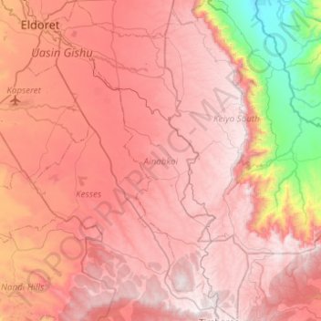
Name: Ainabkoi topographic map, elevation, terrain.
Location: Ainabkoi, Uasin Gishu County, Rift Valley, Kenya (0.06411 35.28213 0.55631 35.59131)
Average elevation: 2,168 m
Minimum elevation: 1,088 m
Maximum elevation: 2,819 m
Thank you for supporting this site ❤️
Make a donation
Make a donation
Gear up for your next adventure:
As an Amazon Associate, this site earns from qualifying purchases at no extra cost to you.