Geolocate

Munda topographic map

Click on the map to display elevation.

About this map

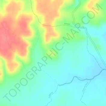
Name: Munda topographic map, elevation, terrain.

Location: Munda, Lakhnadon Tahsil, Seoni District, Madhya Pradesh, India (22.61085 79.77841 22.62709 79.80578)

Average elevation: 584 m

Minimum elevation: 554 m

Maximum elevation: 628 m

Gear up for your next adventure:

🧴Insect Repellent - Protect yourself from bugs during outdoor adventures
🎒Backpack Rain Cover - External shield to keep your entire pack dry
🧭GPS Tracker - Track your location in remote areas safely
🧳Compression Sacks - Maximize space in your backpack by shrinking gear
🧴First Aid Kit - Essential first aid supplies for outdoor emergencies

As an Amazon Associate, this site earns from qualifying purchases at no extra cost to you.