Geolocate

Sudden Valley topographic map

Click on the map to display elevation.

About this map

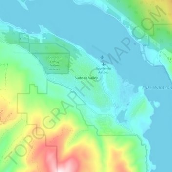
Name: Sudden Valley topographic map, elevation, terrain.

Location: Sudden Valley, Whatcom County, Washington, United States (48.69076 -122.39572 48.74909 -122.30380)

Average elevation: 239 m

Minimum elevation: 87 m

Maximum elevation: 800 m

Other topographic maps

Click on a map to view its topography, its elevation and its terrain.

Gear up for your next adventure:

🧢Sun Protection Cap - Breathable cap to protect from sun exposure
🧭GPS Handheld Device - Reliable GPS navigation for outdoor adventures
Family Camping Tent - Spacious tent suitable for family camping trips
🧭GPS Outdoor Watch - Smart watch for navigation and fitness tracking in nature
🕶️Polarized Sunglasses - Reduces glare from snow and water at high elevations

As an Amazon Associate, this site earns from qualifying purchases at no extra cost to you.