Geolocate

Cogonon topographic map

Click on the map to display elevation.

About this map

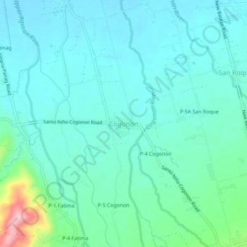
Name: Cogonon topographic map, elevation, terrain.

Location: Cogonon, New Bataan, Davao de Oro, Davao Region, Philippines (7.55284 126.09546 7.59284 126.13546)

Average elevation: 148 m

Minimum elevation: 110 m

Maximum elevation: 324 m

Other topographic maps

Click on a map to view its topography, its elevation and its terrain.

Cateel River

Philippines > Davao de Oro > New Bataan

Average elevation: 586 m

Gear up for your next adventure:

🧢Outdoor Cap - Protective cap for sun and rain during hikes
🥾Waterproof Trail Shoes - Shoes designed to handle wet terrain
🧦Hiking Socks - Moisture-wicking and comfortable socks for long hikes
🔋Lithium AA Batteries - Long-lasting power that performs in extreme cold
🥤Collapsible Travel Cup - Saves space and weight in your mess kit

As an Amazon Associate, this site earns from qualifying purchases at no extra cost to you.