Geolocate

Pics topographic map

Click on the map to display elevation.

About this map

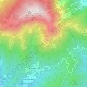
Name: Pics topographic map, elevation, terrain.

Location: Pics, Montenars, Udine, Friuli-Venezia Giulia, 33010, Italy (46.25868 13.17831 46.27868 13.19831)

Average elevation: 798 m

Minimum elevation: 424 m

Maximum elevation: 1,347 m

Gear up for your next adventure:

🥾Waterproof Hiking Shoes - Durable shoes for wet and rugged trails
🔭Compact Binoculars - Lightweight optics for scouting trails and wildlife
Bushcraft Tarp - Versatile emergency shelter or gear protection
🔭Outdoor Binoculars - Lightweight binoculars for birdwatching and hiking
🛶Kayak Dry Bag - Waterproof storage for kayaking adventures

As an Amazon Associate, this site earns from qualifying purchases at no extra cost to you.