
Thank you for supporting this site ❤️
Make a donation
Make a donation
Gear up for your next adventure:
As an Amazon Associate, this site earns from qualifying purchases at no extra cost to you.
Pfaffenbichl topographic map
Click on the map to display elevation.
Thank you for supporting this site ❤️
Make a donation
Make a donation
Gear up for your next adventure:
As an Amazon Associate, this site earns from qualifying purchases at no extra cost to you.
About this map
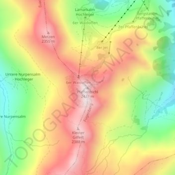
Name: Pfaffenbichl topographic map, elevation, terrain.
Location: Pfaffenbichl, Weerberg, Bezirk Schwaz, Tirol, Österreich (47.24222 11.75514 47.24232 11.75524)
Average elevation: 2,086 m
Minimum elevation: 1,738 m
Maximum elevation: 2,407 m
Thank you for supporting this site ❤️
Make a donation
Make a donation
Gear up for your next adventure:
As an Amazon Associate, this site earns from qualifying purchases at no extra cost to you.