Geolocate

Puentenansa topographic map

Click on the map to display elevation.

About this map

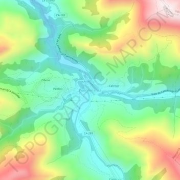
Name: Puentenansa topographic map, elevation, terrain.

Location: Puentenansa, Rionansa, Cantabria, 39554, Spain (43.23321 -4.42724 43.27321 -4.38724)

Average elevation: 379 m

Minimum elevation: 123 m

Maximum elevation: 839 m

Gear up for your next adventure:

💡LED Headlamp - Hands-free illumination for night hiking and camping
🥾Trail Hiking Socks - Comfortable socks to prevent blisters and fatigue
🧴Sunscreen SPF - Broad-spectrum sunscreen for outdoor activities
💡Portable Camping Lamp - Rechargeable lamp for campsite lighting
🐕Hiking Dog Pack - Let your canine companion carry their own water and food

As an Amazon Associate, this site earns from qualifying purchases at no extra cost to you.