
Make a donation
Gear up for your next adventure:
As an Amazon Associate, this site earns from qualifying purchases at no extra cost to you.
Muñoz topographic map
Click on the map to display elevation.
Make a donation
Gear up for your next adventure:
As an Amazon Associate, this site earns from qualifying purchases at no extra cost to you.
Muñoz
Situated 152 kilometres (94 mi) north of the capital Manila and due to its rich topography and tropical climate, it is now home to agricultural research and technology centers, committed to the production of information and technological breakthroughs to promote rural development, productivity and food security.
Make a donation
Gear up for your next adventure:
As an Amazon Associate, this site earns from qualifying purchases at no extra cost to you.
About this map
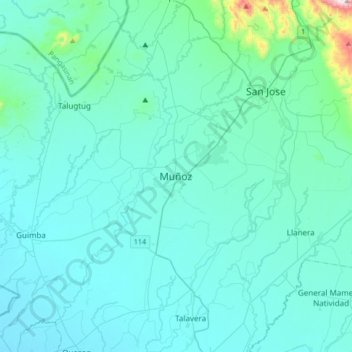
Name: Muñoz topographic map, elevation, terrain.
Location: Muñoz, Nueva Ecija, Central Luzon, 3119, Philippines (15.55354 120.74395 15.87354 121.06395)
Average elevation: 86 m
Minimum elevation: 20 m
Maximum elevation: 794 m
Make a donation
Gear up for your next adventure:
As an Amazon Associate, this site earns from qualifying purchases at no extra cost to you.