
Thank you for supporting this site ❤️
Make a donation
Make a donation
Gear up for your next adventure:
As an Amazon Associate, this site earns from qualifying purchases at no extra cost to you.
Sindri topographic map
Click on the map to display elevation.
Thank you for supporting this site ❤️
Make a donation
Make a donation
Gear up for your next adventure:
As an Amazon Associate, this site earns from qualifying purchases at no extra cost to you.
About this map
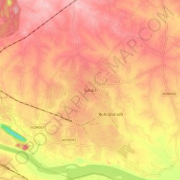
Name: Sindri topographic map, elevation, terrain.
Location: Sindri, Baliapur, Dhanbad, Jharkhand, 828122, India (23.63515 86.44963 23.71515 86.52963)
Average elevation: 160 m
Minimum elevation: 60 m
Maximum elevation: 205 m
Thank you for supporting this site ❤️
Make a donation
Make a donation
Gear up for your next adventure:
As an Amazon Associate, this site earns from qualifying purchases at no extra cost to you.