Geolocate

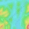
Lac Lamothe topographic map

Click on the map to display elevation.

About this map

Name: Lac Lamothe topographic map, elevation, terrain.

Location: Lac Lamothe, Lac-Croche, La Jacques-Cartier, Capitale-Nationale, Québec, Canada (47.43272 -71.76679 47.43642 -71.76118)

Average elevation: 679 m

Minimum elevation: 610 m

Maximum elevation: 781 m

Other topographic maps

Click on a map to view its topography, its elevation and its terrain.

Lac Sioui

Canada > Québec > La Jacques-Cartier > Lac-Croche

Average elevation: 711 m

Lac Brûlé

Canada > Québec > La Jacques-Cartier > Lac-Croche

Average elevation: 530 m

Gear up for your next adventure:

🥾Waterproof Trail Shoes - Shoes designed to handle wet terrain
🧢Outdoor Cap - Protective cap for sun and rain during hikes
👖Convertible Hiking Pants - Zip-off legs to adapt to changing weather conditions
🌡️Emergency Mylar Blankets - Compact thermal protection for unexpected nights outdoors
🧥Packable Rain Jacket - Breathable waterproof layer for unpredictable weather

As an Amazon Associate, this site earns from qualifying purchases at no extra cost to you.