

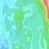
Lincoln topographic map
Click on the map to display elevation.
Lincoln
Lincoln is in northeastern Addison County in the Green Mountains. The Long Trail runs along the crest of the Green Mountains near the town's eastern border, with elevations ranging from 2,430 feet (740 m) at Lincoln Gap to 4,006 feet (1,221 m) at the summit of Mount Abraham. The lowest elevation in town is 840 feet (260 m) above sea level near West Lincoln, where the New Haven River exits the town.
About this map
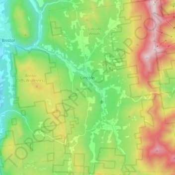
Name: Lincoln topographic map, elevation, terrain.
Location: Lincoln, Addison County, Vermont, 05443, United States (44.03398 -73.03729 44.16282 -72.90520)
Average elevation: 522 m
Minimum elevation: 111 m
Maximum elevation: 1,233 m
Other topographic maps
Click on a map to view its topography, its elevation and its terrain.
Kingsland Bay
United States > Vermont > Addison County > Ferrisburgh > Ecole Champlain
Average elevation: 32 m


Abbey Pond Cascades (lower)
United States > Vermont > Addison County > Middlebury
Average elevation: 305 m

Lake Dunmore
United States > Vermont > Addison County > Salisbury > Lake Dunmore
Average elevation: 192 m


