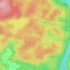
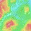
Wentworth topographic map
Click on the map to display elevation.
About this map

Name: Wentworth topographic map, elevation, terrain.
Location: Wentworth, Argenteuil, Laurentides, Quebec, J8H 0B5, Canada (45.74002 -74.44097 45.84722 -74.30856)
Average elevation: 323 m
Minimum elevation: 208 m
Maximum elevation: 453 m
Argenteuil trails, hiking, mountain biking, running and outdoor activities
Other topographic maps
Click on a map to view its topography, its elevation and its terrain.

Pointe-au-Chêne
Canada > Quebec > Argenteuil > Grenville-sur-la-Rouge > Pointe-au-Chêne
Average elevation: 94 m