Geolocate

Le Recoin topographic map

Click on the map to display elevation.

Le Recoin

Chamrousse est une commune française située géographiquement en altitude dans les Alpes à l'extrémité sud de la chaîne de Belledonne, au-dessus de la vallée du Grésivaudan et de l'agglomération grenobloise, administrativement dans le département de l'Isère, en région Auvergne-Rhône-Alpes et autrefois rattachée à l'ancienne province du Dauphiné.

Wikipedia (CC-BY-SA 3.0)

About this map

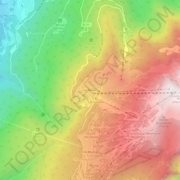
Name: Le Recoin topographic map, elevation, terrain.

Location: Le Recoin, Chamrousse, Grenoble, Isère, Auvergne-Rhône-Alpes, France métropolitaine, 38410, France (45.10621 5.85697 45.14621 5.89697)

Average elevation: 1,518 m

Minimum elevation: 728 m

Maximum elevation: 2,250 m

Gear up for your next adventure:

🥾Trekking Boots - Durable boots for long-distance trekking
🥾Hiking Boots - Sturdy boots providing ankle support and traction on rugged trails
🥾Hiking Gaiters - Protect legs and shoes from mud, snow, and debris
🧭GPS Tracker - Track your location in remote areas safely
🧢Hiking Sun Hat - Wide-brimmed protection for exposed mountain ridges

As an Amazon Associate, this site earns from qualifying purchases at no extra cost to you.