Geolocate

Banna topographic map

Click on the map to display elevation.

About this map

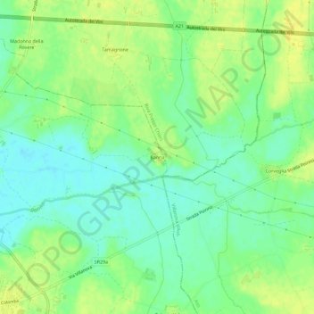
Name: Banna topographic map, elevation, terrain.

Location: Banna, Poirino, Torino, Piedmont, 10046, Italy (44.91855 7.86252 44.95855 7.90252)

Average elevation: 249 m

Minimum elevation: 238 m

Maximum elevation: 259 m

Gear up for your next adventure:

🧢Sun Protection Cap - Breathable cap to protect from sun exposure
🔪Outdoor Multitool - Versatile tool for repairs and food prep in the wild
🔦LED Flashlight - Powerful and long-lasting flashlight for camping and emergencies
🦟Insect Repellent - Keep mosquitoes and black flies away in wooded areas
🧴Bear Spray Holster - Quick-access carry for essential Canadian wilderness safety

As an Amazon Associate, this site earns from qualifying purchases at no extra cost to you.