Geolocate

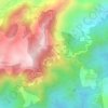
Guadalupe River topographic map

Click on the map to display elevation.

About this map

Name: Guadalupe River topographic map, elevation, terrain.

Location: Guadalupe River, Babag Ⅰ, Cebu City, Central Visayas, Philippines (10.33146 123.85505 10.35517 123.87377)

Average elevation: 220 m

Minimum elevation: 58 m

Maximum elevation: 534 m

Other topographic maps

Click on a map to view its topography, its elevation and its terrain.
Gear up for your next adventure:

🧳Compression Sacks - Maximize space in your backpack by shrinking gear
💧Hydration Bladder - Hands-free hydration solution for long treks
🎒Hiking Daypack - Lightweight and durable backpacks for day trips and excursions
🧥Softshell Hiking Jacket - The perfect balance of wind protection and breathability
🧴Sunscreen SPF - Broad-spectrum sunscreen for outdoor activities

As an Amazon Associate, this site earns from qualifying purchases at no extra cost to you.