
Thank you for supporting this site ❤️
Make a donation
Make a donation
Gear up for your next adventure:
As an Amazon Associate, this site earns from qualifying purchases at no extra cost to you.
Sangolquí topographic map
Click on the map to display elevation.
Thank you for supporting this site ❤️
Make a donation
Make a donation
Gear up for your next adventure:
As an Amazon Associate, this site earns from qualifying purchases at no extra cost to you.
About this map
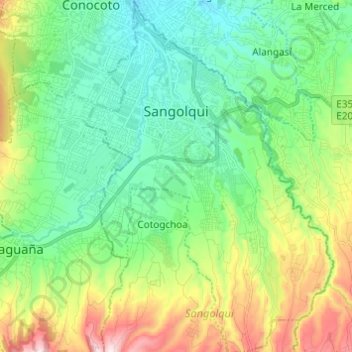
Name: Sangolquí topographic map, elevation, terrain.
Location: Sangolquí, Sangolqui, Pichincha, Ecuador (-0.41259 -78.47959 -0.29076 -78.39376)
Average elevation: 2,645 m
Minimum elevation: 2,437 m
Maximum elevation: 3,139 m
Thank you for supporting this site ❤️
Make a donation
Make a donation
Gear up for your next adventure:
As an Amazon Associate, this site earns from qualifying purchases at no extra cost to you.