Geolocate

La Foyaca topographic map

Click on the map to display elevation.

About this map
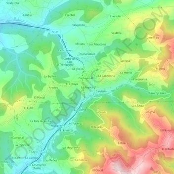
Name: La Foyaca topographic map, elevation, terrain.

Location: La Foyaca, Siero, Asturias, 33936, España (43.32339 -5.64879 43.36339 -5.60879)

Average elevation: 375 m

Minimum elevation: 222 m

Maximum elevation: 649 m

Other topographic maps

Click on a map to view its topography, its elevation and its terrain.

San Juan Arenas

España > Asturias > Siero

Average elevation: 334 m

Santiago Arenas

España > Asturias > Siero

Average elevation: 400 m

Collado

España > Asturias > Siero

Average elevation: 288 m

Collado

España > Asturias > Siero

Average elevation: 288 m

Gear up for your next adventure:

🦌Outdoor Trail Camera - Monitor wildlife activity near your favorite spots
📷Outdoor Action Camera - Capture high-elevation views and rugged adventures
🧥Thermal Layer - Insulating layer for cold outdoor conditions
👟Sport Hiking Sandals - Breathable footwear for water crossings and camp rest
🔦LED Headtorch - Bright and durable light for night activities

As an Amazon Associate, this site earns from qualifying purchases at no extra cost to you.