
Thank you for supporting this site ❤️
Make a donation
Make a donation
Gear up for your next adventure:
As an Amazon Associate, this site earns from qualifying purchases at no extra cost to you.
Kana Mission topographic map
Click on the map to display elevation.
Thank you for supporting this site ❤️
Make a donation
Make a donation
Gear up for your next adventure:
As an Amazon Associate, this site earns from qualifying purchases at no extra cost to you.
About this map
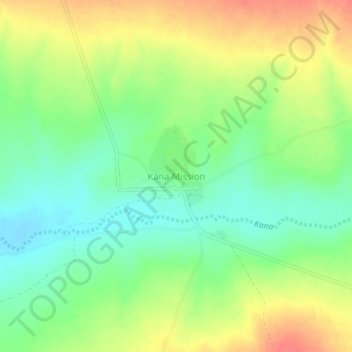
Name: Kana Mission topographic map, elevation, terrain.
Location: Kana Mission, Gokwe South, Midlands Province, Zimbabwe (-18.57609 28.49813 -18.53609 28.53813)
Average elevation: 1,146 m
Minimum elevation: 1,121 m
Maximum elevation: 1,176 m
Thank you for supporting this site ❤️
Make a donation
Make a donation
Gear up for your next adventure:
As an Amazon Associate, this site earns from qualifying purchases at no extra cost to you.