Geolocate

Devils Shores topographic map

Click on the map to display elevation.

About this map

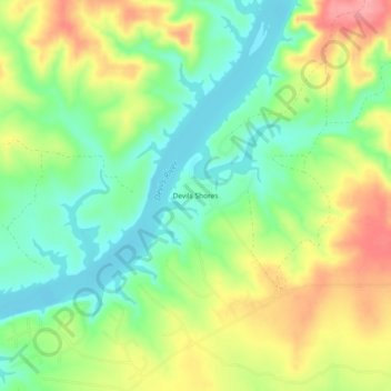
Name: Devils Shores topographic map, elevation, terrain.

Location: Devils Shores, Val Verde County, Texas, United States (29.60105 -100.95704 29.64105 -100.91704)

Average elevation: 375 m

Minimum elevation: 333 m

Maximum elevation: 432 m

Other topographic maps

Click on a map to view its topography, its elevation and its terrain.

Del Rio

United States > Texas > Val Verde County

Average elevation: 311 m

Del Rio

United States > Texas > Val Verde County

Average elevation: 310 m

Gear up for your next adventure:

🥾Light Trekking Boots - Supportive boots for multi-day treks
🧦Outdoor Socks - Durable socks designed for hiking and outdoor sports
💧Hydration Pack - Hands-free hydration system for long hikes
🎒Fully Waterproof Backpack - Total protection for photography gear and electronics
🛌Insulated Sleeping Pad - Critical thermal barrier between you and the cold ground

As an Amazon Associate, this site earns from qualifying purchases at no extra cost to you.