Geolocate

Marysvale topographic map

Click on the map to display elevation.

About this map

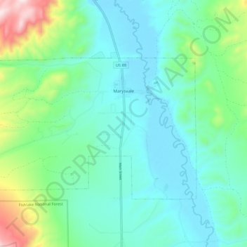
Name: Marysvale topographic map, elevation, terrain.

Location: Marysvale, Piute County, Utah, United States (38.41270 -112.31055 38.46065 -112.19869)

Average elevation: 1,928 m

Minimum elevation: 1,771 m

Maximum elevation: 2,645 m

Other topographic maps

Click on a map to view its topography, its elevation and its terrain.

Phonolite Hill

United States > Utah > Piute County

Average elevation: 2,098 m

Gear up for your next adventure:

🧣Evaporative Cooling Towel - Beat the heat during intense summer climbs
🐕Hiking Dog Pack - Let your canine companion carry their own water and food
💧Collapsible Water Bottle - Space-saving water bottle for outdoor activities
Lightweight Backpacking Tent - Compact tent for efficient hiking trips
🦌Outdoor Trail Camera - Monitor wildlife activity near your favorite spots

As an Amazon Associate, this site earns from qualifying purchases at no extra cost to you.