Geolocate

Pozzuolo topographic map

Click on the map to display elevation.

About this map

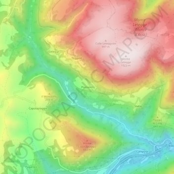
Name: Pozzuolo topographic map, elevation, terrain.

Location: Pozzuolo, Camerino, Macerata, Marche, Italy (43.13061 13.11351 43.17061 13.15351)

Average elevation: 656 m

Minimum elevation: 305 m

Maximum elevation: 1,021 m

Gear up for your next adventure:

🚲MTB Frame Bag - Carry tools and maps directly on your bicycle frame
🛏️Sleeping Bag - Warm and compact sleeping bags for outdoor camping
🔦LED Flashlight - Powerful and long-lasting flashlight for camping and emergencies
🥾Hiking Shorts - Breathable shorts suitable for summer hikes
🧭GPS Handheld Device - Reliable GPS navigation for outdoor adventures

As an Amazon Associate, this site earns from qualifying purchases at no extra cost to you.