Geolocate

Parker topographic map

Click on the map to display elevation.

About this map
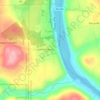
Name: Parker topographic map, elevation, terrain.

Location: Parker, Armstrong County, Pennsylvania, United States (41.07850 -79.69020 41.10328 -79.67350)

Average elevation: 323 m

Minimum elevation: 254 m

Maximum elevation: 407 m

Gear up for your next adventure:

💧Filtered Water Bottle - Safe drinking water on the go
🛌Down Sleeping Bag - Superior warmth-to-weight ratio for cold nights
🧥Waterproof Jacket - Lightweight rain jackets for hiking and outdoor activities
🧦Merino Wool Socks - Moisture-wicking comfort for long-distance hiking
🥾Mountain Hiking Shoes - Shoes with superior grip for mountainous terrain

As an Amazon Associate, this site earns from qualifying purchases at no extra cost to you.